SAM'S MESA TRAIL
TRAIL PAGE LINKS
Angel Point Trail
Blarney Trail
Blue Benches
Bull Creek Pass
Burro Wash East
Burro Wash Trail
Cathedral Valley
Cooks Mesa
Cottonwood Wash Trail
Curtis Bench
Dark Valley Trail
Donkey Reservoir
Five Mile Wash
Fremont River Trail
Geyser Peak
Great Western Trail
Hemlock Meadows
Horseshoe Canyon
Leprechaun Trail
Little Wild Horse Trail
Lower Bowns / Oak Creek Trail
Moonscapes and Goblins
Mt. Ellen
North Caineville Mesa
North Slope
Planets to the Past
Pleasant Creek Trail
Poison Spring
Robber’s Roost Trail
Sam’s Mesa Trail
Sheets Gultch Trail
Shillelagh Trail
South Caineville Mesa
Sunglow Trail
Swing Arm City
Tantalus Flats
Thousand Views Trail
Tidwell Slopes
Velvet Ridge / Hell’s Hole
LOCATION
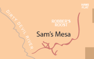
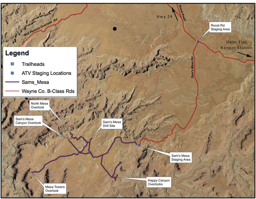
The Roost Rd. is a B Class road that will take you to the staging point on the Sam’s Mesa Rd.
TRAIL TYPE
Depending on the road conditions you can drive a truck to staging area. After that point it is recommended that only ATV’s and experienced OHV riders do the trail.
DISTANCE
The distance from the Roost Rd. staging area to the Mesa Towers Overlook is 15 miles.
DIFFICULTY
For an ATV this trail is EASY. For OHV’s it is MODERATE with some difficult parts.
TRAIL DESCRIPTION
The whole area is BLM land. The trail is sandy with some rocky spots.
TRAIL COORDINATES / POINTS OF INTEREST
| Name | GPS | Latitude | Longitude |
| Roost Rd/Sams Mesa Rd Junction | N 38d15’58” W 110d16’06” | 38.266111 | -110.2683 |
| Sams Mesa Staging Area | N 38d11’27” W 110d19’23” | 38.190833 | -110.323056 |
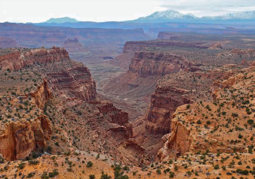
| Happy Canyon Overlook | N 38d09’55” W 110d20’42” | 38.165278 | -110.345 |
| Mesa Towers Overlook | N 38d10’19” W 110d25’21” | 38.171944 | -110.4225 |
| Sams Mesa Canyon Overlook | N 38d11’41” W 110d23’15” | 38.194722 | -110.3875 |
| North Mesa Overlook | N 38d12’03” W 110d23’11” | 38.200833 | -110.386389 |
| Sams Mesa Drill Site | N 38d11’48” W 110d21’58” | 38.196667 | -110.366111 |
EQUIPMENT
This trail is designated for ATV, and experienced Jeep riders.
ENVIRONMENT
Check the weather conditions, but this trail is pretty good in all weather that you would want to be out in.
SAFETY
Make sure that you only go out there in anything but an ATV if you are experienced. This way you will continue to be safe on the trails.
TRAIL TIP
Be careful where you ride because there is some wilderness study areas out there. The areas are well marked, so pay attention to the signs.
| Title | Category | Address | Description | Link |
|---|
Take in the Views
Get a Closer Look
TRAILS MASTER MAP
| Title | Category | Address | Description | Link |
|---|
Other Trail Pages
