

Walk Amongst Giants
Cathedral Valley
Curated Experiences
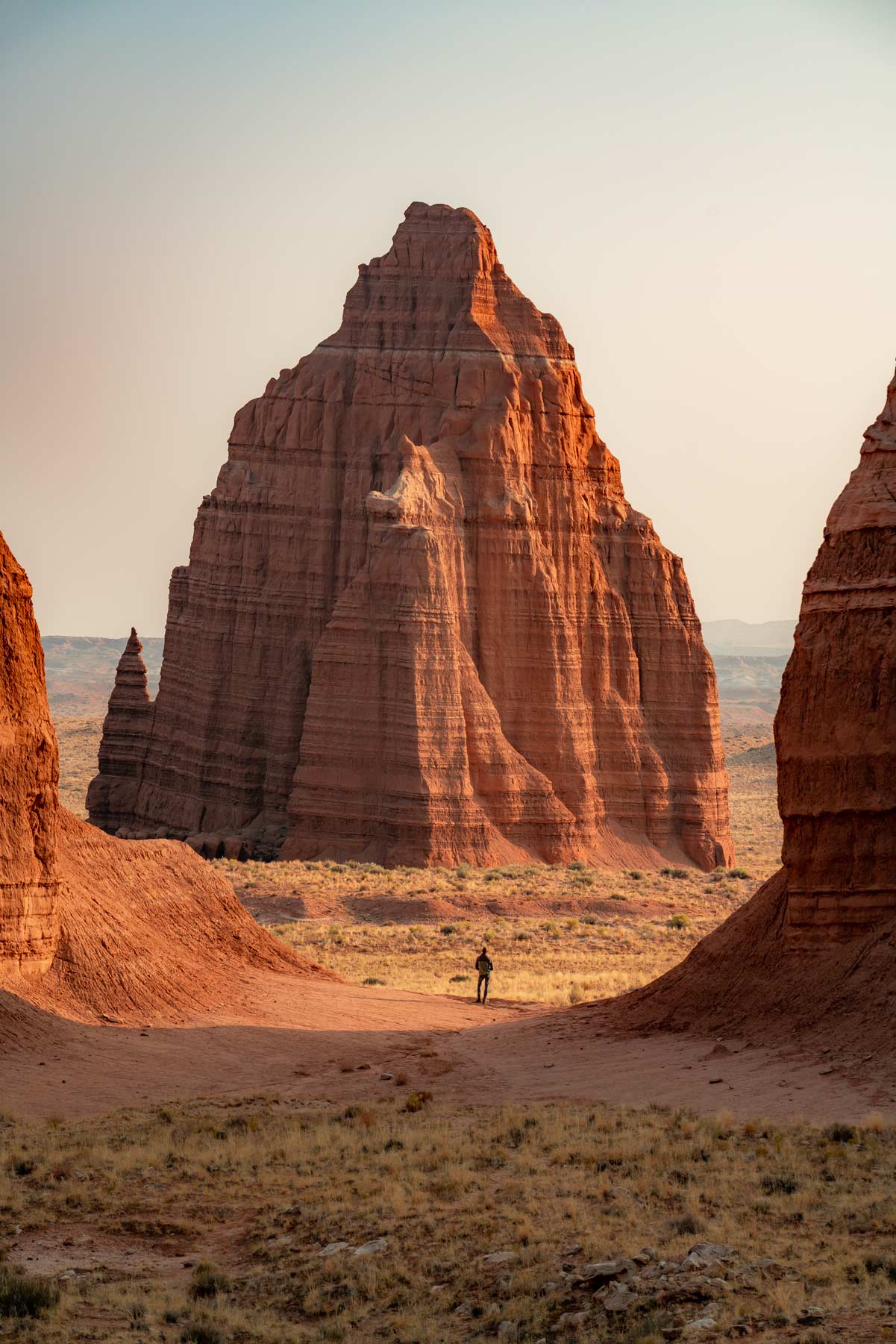
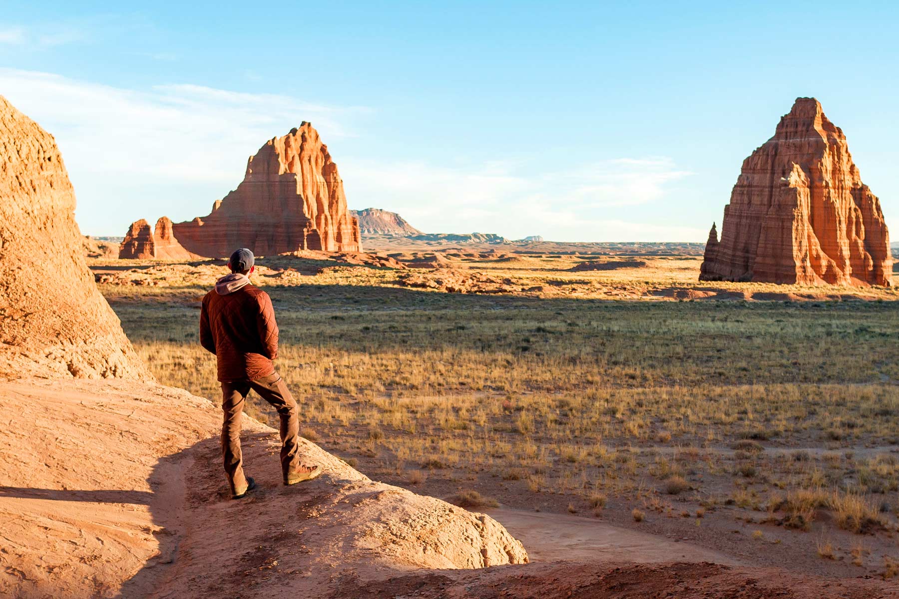
Temples of the Sun & Moon
Touring Cathedral ValleyTHE LAND
Sites Along the Way to Cathedral Valley
Bentonite Hills: Early on Hartnet Road, these colorful, rounded hills shine in red, purple, and gray tones. Formed from volcanic ash that’s turned to clay, they‘re a dramatic introduction to the loop‘s otherworldly landscape, shining brightly at sunrise or sunset.
Upper South Desert Overlook: Approximately 27 miles in, a short walk from the road provides a spectacular view of the South Desert. Red cliffs line the horizon, and the untouched openness feels timeless—imagine buffalo roaming below to grasp its scale.
Upper Cathedral Valley Overlook: Near Hartnet Junction, this viewpoint showcases the valley’s namesake “cathedrals”—Entrada sandstone monoliths rising like Gothic spires. A brief hike offers close-up views, especially magical in evening light.
Gypsum Sinkhole: A mile-long spur off Cathedral Road leads to this 50-foot-wide, 200-foot-deep chasm. Formed by dissolved gypsum collapsing underground, it’s a stark reminder of the area’s dynamic geology.
Temples of the Sun and Moon: These twin giants of sandstone tower over Lower Cathedral Valley at mile 52. The Temple of the Sun stands more than 400 feet tall, ablaze at sunrise, while the nearby Temple of the Moon and Glass Mountain—a mound of sparkling gypsum crystals—contribute to the otherworldly beauty.
Wildlife in the Area: Cathedral Valley’s desert environment supports a variety of tough wildlife. Mule deer live in the higher elevations near the Cathedral Valley Campground, and pronghorn antelope race across open flats. Bighorn sheep are found scaling rocky cliff faces, their surefootedness a marvel. Smaller animals like jackrabbits, kangaroo rats, and lizards—like the side-blotched or collared varieties—scamper through the sagebrush. Birds of prey, like golden eagles and red-tailed hawks, soar on the thermals overhead, stalking from on high. At night, try to hear great horned owl hoots or coyote yips echoing across the valley. While sightings are rare due to the lack of human activity, bring binoculars and keep a distance—wildlife feeding is prohibited.
Plan
Your Visit
- Accessing Cathedral Valley requires careful planning and preparation. High-clearance vehicles are an important detail, as the roads are unpaved and can be challenging.
- Visitors should be prepared for potential hazards, including extreme temperatures, limited resources, and the possibility of encountering difficult road conditions, especially after rain.
- It is important to check weather and road conditions before venturing into the valley and to carry ample supplies of water, food, and emergency equipment.
-
Pack plenty of water, lunch, and sunscreen.
Facilities in the campground amount to no more than a pit toilet. The solitude—less than 1% of park visitors make this journey only adds to the adventure, but it is important to be prepared.