BULL CREEK PASS
TRAIL PAGE LINKS
Angel Point Trail
Blarney Trail
Blue Benches
Bull Creek Pass
Burro Wash East
Burro Wash Trail
Cathedral Valley
Cooks Mesa
Cottonwood Wash Trail
Curtis Bench
Dark Valley Trail
Donkey Reservoir
Five Mile Wash
Fremont River Trail
Geyser Peak
Great Western Trail
Hemlock Meadows
Horseshoe Canyon
Leprechaun Trail
Little Wild Horse Trail
Lower Bowns / Oak Creek Trail
Moonscapes and Goblins
Mt. Ellen
North Caineville Mesa
North Slope
Planets to the Past
Pleasant Creek Trail
Poison Spring
Robber’s Roost Trail
Sam’s Mesa Trail
Sheets Gultch Trail
Shillelagh Trail
South Caineville Mesa
Sunglow Trail
Swing Arm City
Tantalus Flats
Thousand Views Trail
Tidwell Slopes
Velvet Ridge / Hell’s Hole
LOCATION
20 miles south of Hanksville. Bull Creek Pass circles west of the UT 95 and UT 276.
TRAIL TYPE
Bull Creek Pass is a SELF-GUIDED auto tour. There are hiking trails along the road. The lower parts of the pass are open all year.
DISTANCE
The loop is 68 miles long. The pass could take anywhere from 6-8 hours, depending on how often and for how long you stop.
DIFFICULTY
MODERATE – This varies depending on the weather. Make sure you are aware of previous and upcoming weather conditions.
TRAIL DESCRIPTION
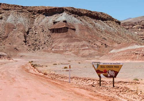
Bull Creek Pass takes you up and through the Henry Mountains. Even though the road can me small in parts, make sure you stay on the designated path so you do not destroy the wildlife.
TRAIL COORDINATES / POINTS OF INTEREST
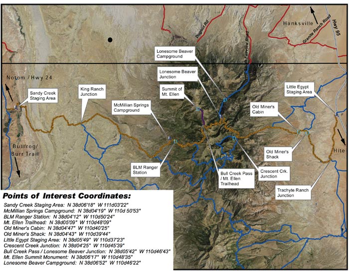
| GPS | Latitude | Longitude | |
| Sandy Creek Staging Area | N 38d6’18” W 111d03’22” | 38.105 | -111.056111 |
| McMillian Springs Campground | N 38d4’19” W 110d50’53” | 38.071944 | -110.848056 |
| BLM Ranger Station | N 38d4’12” W 110d50’24” | 38.07 | -110.84 |
| Mt Ellen Trailhead | N 38d5’09” W 110d48’09” | 38.085833 | -110.8025 |
| Old Miners Cabin | N 38d4’47” W 110d40’25” | 38.079722 | -110.673611 |
| Old Miners Shack | N 38d4’43” W 110d39’44” | 38.078611 | -110.662222 |
| Little Egypt Staging Area | N 38d5’49” W 110d37’23” | 38.096944 | -110.623056 |
| Crescent Creek Junction | N 38d4’25” W 110d45’39” | 38.073611 | -110.760833 |
| Bull Creek Pass / Lonesome Beaver Junc | N 38d5’42” W 110d46’43” | 38.095 | -110.778611 |
| Mt Ellen Summit Monument | N 38d6’17” W 110d48’35” | 38.104722 | -110.809722 |
| Lonesome Beaver Campground | N 38d6’52” W 110d46’22” | 38.114444 | -110.772778 |
EQUIPMENT
This loop was designed for 4WD vehicles only. Some part are more easily accessed with smaller vehicles.
ENVIRONMENT
The trail can be washed out after a heavy rain. The higher parts of the pass are closed from November to June.
SAFETY
If you run into problems, help may not be able to arrive for days so make sure you are prepared with enough food, water and clothing.
TRAIL TIP
Make sure someone knows your plans just in case you run into trouble. They will know to send help if you do not return in an expected amount of time.
| Title | Category | Address | Description | Link |
|---|

Take in the Views
Southern Utah’s Henry Mountian Range was the last of the contiental United States’ mountains to be explored..
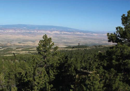
The Bull Creek Pass takes you to the top of the Henry Mountians where you can see the very views that define southern Utah.

Get a Closer Look

Do it at Your Own Pace

TRAILS MASTER MAP
Other Trail Pages


