BLUE BENCHES
TRAIL PAGE LINKS
Angel Point Trail
Blarney Trail
Blue Benches
Bull Creek Pass
Burro Wash East
Burro Wash Trail
Cathedral Valley
Cooks Mesa
Cottonwood Wash Trail
Curtis Bench
Dark Valley Trail
Donkey Reservoir
Five Mile Wash
Fremont River Trail
Geyser Peak
Great Western Trail
Hemlock Meadows
Horseshoe Canyon
Leprechaun Trail
Little Wild Horse Trail
Lower Bowns / Oak Creek Trail
Moonscapes and Goblins
Mt. Ellen
North Caineville Mesa
North Slope
Planets to the Past
Pleasant Creek Trail
Poison Spring
Robber’s Roost Trail
Sam’s Mesa Trail
Sheets Gultch Trail
Shillelagh Trail
South Caineville Mesa
Sunglow Trail
Swing Arm City
Tantalus Flats
Thousand Views Trail
Tidwell Slopes
Velvet Ridge / Hell’s Hole
LOCATION
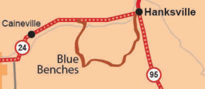
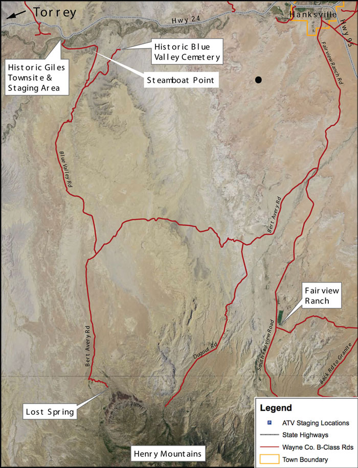
Staging areas in Hanksville and Giles. In Hanksville, go south 100 E and stay right on the intersection. 7 miles south of town you will start the loop at the Burt Avery fork.
TRAIL TYPE
Road passable only to ATV or 4WD, SUV (depending on the weather). Bicycles may also do this trail.
DISTANCE
This trail length can very depending of what you decide to do. Recommended loop is about 20 miles long, not including the distance from Giles to Hanksville.
DIFFICULTY
MODERATE – There are some river crossings that they have put cement down for path to cross. The water is 1-2 feet deep.
TRAIL DESCRIPTION
The whole trail is B Class county maintained road. Spur roads that are open to riding are D class county roads. There are also several washes along the trail.
Trails
10.0 Miles – Historic Giles Townsite/Hwy 24 to Bert Avery Rd.
2.1 Miles – Blue Valley Cemetery Road
5.5 Miles – Blue Valley Rd. to Lost Springs
6.7 Miles – Blue Valley Rd. to Dugout Rd.
6.9 Miles – Dugout Road
4.1 Miles – Bert Avery/Fairview Rd. Junction to Dugout Road
16.3 Miles – Bert Avery/Fairview Rd. Junction to Lost Spring
TRAIL COORDINATES / POINTS OF INTEREST
| GPS | Latitude | Longitude | |
| Fremont River Crossing | N 38d21″29″ W 110d52’27” | 38.358056 | -110.874167 |
| Historic Blue Valley Cemetery | N 38d21’12” W 110d50’22” | 38.353333 | -110.839444 |
| Lost Spring | N 38d11’05” W 110d50’52” | 38.184722 | -110.847778 |
| Fairview Ranch | N38d12’58” W 110d44’22” | 38.216111 | -110.739444 |

EQUIPMENT
This trail has been designed for ATV, Jeep, 4WD or bicycle.
ENVIRONMENT
The weather varies greatly and will affect the road. The rain will flood Giles and other parts of the trails.
SAFETY
Make sure to check the weather reports before starting this trail. The weather will also affect what kind of vehicle will be able to do the trail.
TRAIL TIP
Take some time to explore the spur trails. There are many interesting and beautiful sites to see so make the most of your excursion and try to fit a couple in!
| Title | Category | Address | Description | Link |
|---|

Take in the Views
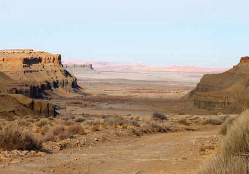
On this trail you will witness the Henry Mountain range in all its glory rising 5000ft in front of you.
Other Points of Interest:
- Fremont River Crossing
- Historic Blue Valley Cemetery
- Lost Spring
- Fairview Ranch

Get a Closer Look
South of Hanskville, there are foothills and as you circle around on the Burt Avery Rd. there are small ridges that you ride to and ledges to look over.
South Fairview Road connects to Henrys and takes you up the mountain. Along the way there in and out spur trails.

TRAILS MASTER MAP
Other Trail Pages


