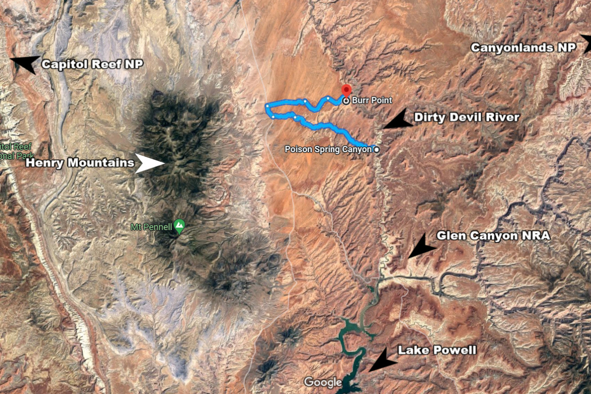
Poison Spring Canyon
Located 17 miles south of the town of Hanksville on SR-95 between the Caineville Desert and Glen Canyon is Poison Spring where outlaws, cowboys and native Americans once roamed. This single trail track is the only motorized route that crosses the Dirty Devil River between Hanksville and Hite located in Glen Canyon National Recreation area. The route progressively becomes narrower as it winds through an ever-deepening canyon approaching the Dirty Devil River. Along the way are spots to view petroglyphs, a side canyon where you’ll find an ancient pit-house dwelling inside a cave, and even a spot where outlaws left their personal inscriptions and rock art.
Cowboys and Outlaws
In the early 1800’s the Poison Spring Canyon was a route used by cattle rustlers moving cattle on and off nearby Robbers Roost, a frequent hideout in the remote desert east of Canyonlands. This remote and barren land was often used in the late nineteenth century as a sanctuary from the law by Butch Cassidy and other western outlaws of this region.
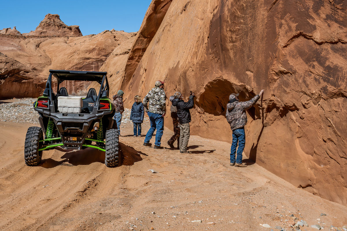
As you travel through the canyon evidence of early old-time cowboys can be seen on the walls of the canyon with names etched in sandstone. Poison Spring Canyon was used by not only cowboys and outlaws, it was also frequented by early indigenous people and Spanish explorers as a main trail through this harsh high desert region where water could be found.
Early Native Americans
Numerous rock art sites of petroglyphs can be found on the cliff walls throughout the route, and even a side canyon where you’ll find an ancient pit-house dwelling inside a cave showing evidence of early Indigenous people inhabiting this area at about the time of the Ancestral Puebloans in the Four Corners region.
Petroglyphs of buffalo, big horn sheep, paw prints, and hunters with bow and arrow may tell a story of the wildlife and hunting in the nearby Henry Mountains. Also found in the canyon are spirals representing a journey and change of life. But perhaps the most notable petroglyph is the Kokopelli, the fertility god, usually depicted as a humpbacked flute player, who Native American cultures believe presides over childbirth and agriculture. Kokopelli is also associated with fun, merrymaking and appreciation of life as symbolized by his flute.
Butch Cassidy Name
Just off the trail in a secluded campsite Butch Cassidy’s name can be found on a large boulder at the foot of the canyon wall. Near his name, also etched in the rock, can also be found two faces etched in the rock with the initials S.J. and the year 1869. It shouldn’t be too much of a surprise to find this name in rock since this was a popular route frequented by old Butch.
Please Note: This route is for four-wheel drive high clearance off-highway vehicles and can be washed out in spots from possible recent weather conditions. Be sure to check conditions prior to venturing into the remote area.
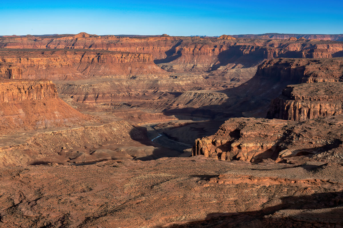
Burr Point
From the Poison Spring Trail and Highway 95 it is possible to make your way east across the plateau on dirt roads and trails to Burr Point, one of southeast Utah’s best scenic viewpoints that overlooks the dramatic and convoluted landscapes of the Dirty Devil River, Sams Mesa, and Robbers Roost.
Keep Capitol Reef Country Forever Mighty
What is Forever Mighty? It’s practicing responsible travel while visiting Utah and Capitol Reef Country by following the principles of Tread Lightly and Leave No Trace.
Plan ahead and prepare, travel and camp on durable surfaces, dispose of waste properly, leave what you find, minimize campfire impacts, respect wildlife, be considerate of others, support local business and honor community, history and heritage. Help us keep Utah and Capitol Reef Country’s outdoor recreation areas beautiful, healthy, and accessible.