

June 15, 2022
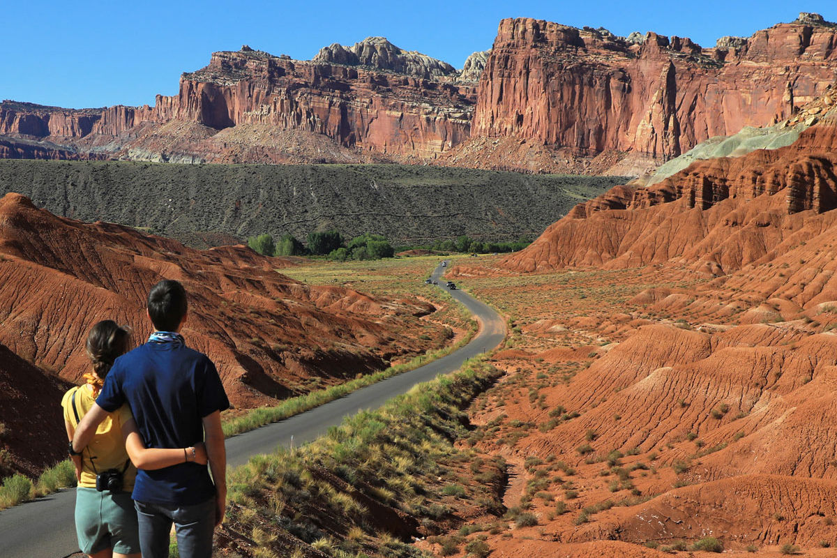
A popular Utah vacation for travelers from many parts of the world is to visit the state’s Mighty Five national parks. Often these trips have a very limited time at each park due to the amount of travel required to see each park. Arches and Canyonlands National Parks are located near Colorado to the east and Zion and Bryce Canyon National Parks are closer to Arizona and Nevada in the southwest section of the state. Capitol Reef National Park is in the center. The distances between the parks are lengthy with all roads being scenic routes. There will be many stops along the way, don’t be in a hurry!
Capitol Reef National Park
Capitol Reef National Park is the center of the Mighty Five located approximately 145 miles from Moab and 119 miles from Bryce Canyon. It’s a large park covering 378 sq miles, second only to Canyonlands National Park of Utah’s parks. There are only two paved roads that give access to many of the main attractions of the park, but the majority of Capitol Reef is backcountry that is accessible by dirt roads only, some requiring high clearance vehicles. If your plans include Cathedral Valley and the southern sections of the Waterpocket Fold, we recommend checking road conditions with the visitors center before venturing off to these areas. In this article we’ll cover places you can visit on the paved roads.
Hiking Trails
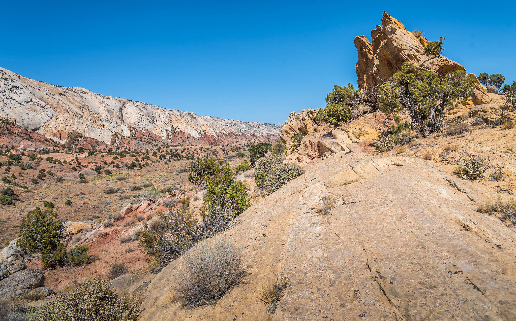
Capitol Reef is a hiker’s paradise! Miles of hiking trails are available for all levels of hiking ability. However, if you have only a day or less to spend in the park, we recommend taking one longer hike and shorter walks to viewpoints. Hikes such as the Grand Wash, Chimney Rock, Cohab Canyon, and Hickman Bridge would be ideal for longer hikes. If you drive through Capitol Gorge at the end of Scenic Drive, Pioneer Register is another trail you can take.
Paved Roads
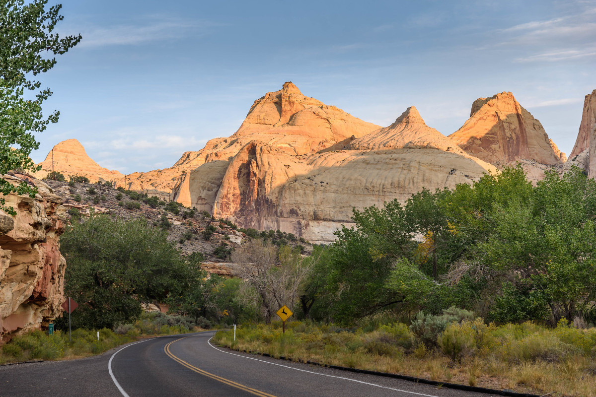
State Route 24 runs through the main section of the park, and the 6.5-mile Scenic Drive (one-way) between the Fruita campground and Capitol Gorge are the two paved roads in the park. If you have less than a day to see the park you can drive both roads to see many of the park’s main points of interest.
State Route 24
SR-24 is the main route through Capitol Reef where many roadside turnouts, and trailheads are located, this is the most visited section of the park. It is also an essential highway; therefore, park fees are not charged in this section.
Points of Interest on SR-24 to the Visitors Center
If traveling from the town of Torrey on the west side of the park, here are the main points of interest worth visiting if you have limited time. (All points are in order of travel going east on SR-24)
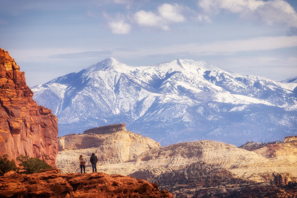
Panorama Point – This is a short spur road off the highway to a circular parking lot where you can take a short walk up a hill to 360-degree views of the park.
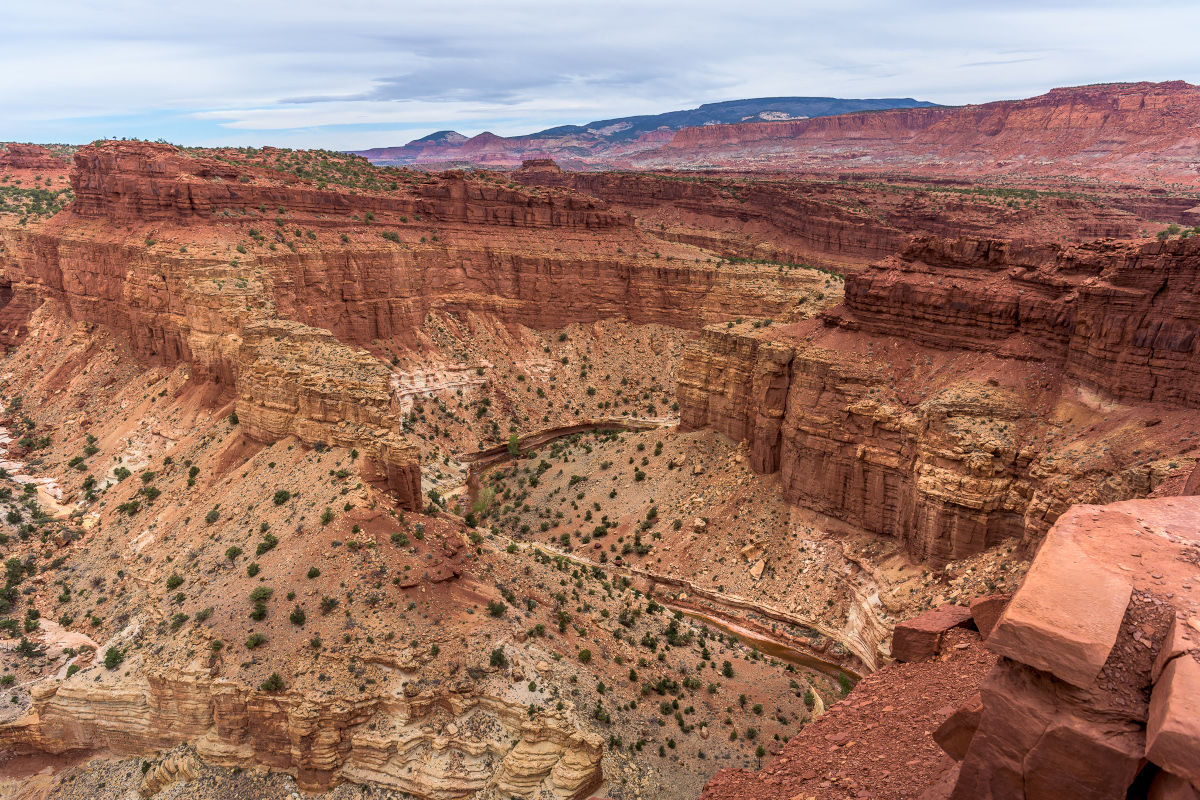
Goosenecks Overlook – .08-mile graded dirt road from the Panorama Point parking lot to a short easy walk to an overlook of the Sulphur Creek meander below with panoramic views of surrounding landscape including the Moenkopi Formation Navajo Knobs.
Sunset Point – In the same parking area for the Goosenecks Overlook the Sunset Point trail leads hikers on a short easy hike (.04 mile) to another panoramic view that’s best at sunset.
Fluted Wall Turnout – Viewpoint of Moenkopi Rock Formations.
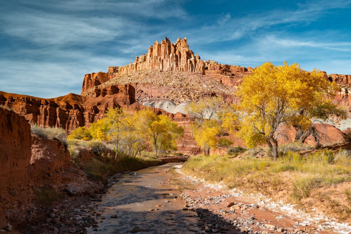
The Castle Turnout – View of iconic rock formation resembling a castle that can also be seen from the visitors center.
At this point you can stop at the visitors center where there is a gift shop, restrooms, information and where you can pay to take the Scenic Drive to Capitol Gorge.
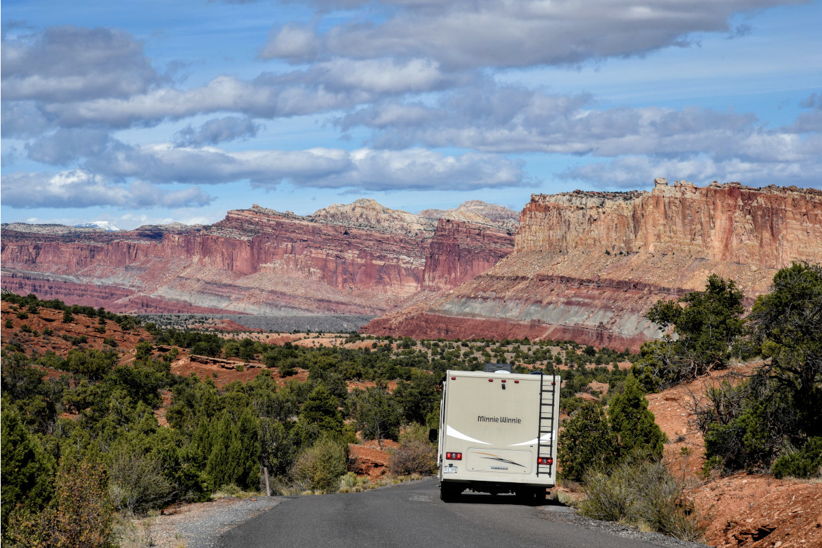
Scenic Drive to Capitol Gorge
From the visitors center, turn south (right) to drive through the Historic Fruita District where pioneer homes, barn, orchards and campground are located. This is one of the original sites where the early settlers homesteaded near the Fremont River. Scenic Drive begins just past the Fruita Campground and ends at the entrance to Capitol Gorge where there is a vault toilet, picnic tables and parking area. The total distance is 13 miles round-trip.
Gifford House – This historic home lies in the heart of the Fruita Historic District that must look like an oasis of green set within red rock canyons. If you like pie, homemade bread and jams then this is a stop you’ll want to make. Small personal size fruit pies are available for purchase along with other homemade treats and crafts. Picnic tables are available outside of the home.
Grand Wash – Two miles from the Fruita Campground is the turn to Grand Wash and Cassidy Arch. Grand Wash is 4.4 miles out and back hike (2.2 miles each way). As the name implies the trail is within a deep canyon that narrows as it follows a dry wash. The trail ends at SR-24 where hikers can also access the trail.
Capitol Gorge – Where the pavement ends on the Scenic Drive, a dirt road begins through Capitol Gorge. The road is sandy in some spots but suitable for automobiles. The entrance gate will most likely be closed when it rains or when the road is wet. You do not want to be caught in the gorge during a thunderstorm! The road is 2.2 miles long from the entrance and ends at a small parking lot where there is a vault toilet and trailheads to several hikes including the Pioneer Register where early settlers carved and shot their names in the canyon walls.
There are several turnouts along Scenic Drive where you can take in the views.
Back to State Route 24
Back on SR-24 at the visitors center, turn right (east) to continue through the main section of the park. From the visitors center to the east entrance is nine miles.
Fruita Schoolhouse – This historic one-room schoolhouse was originally constructed in 1896 and was used until 1941. In addition to serving as the schoolhouse it was also used for social gatherings.
Fremont Petroglyph Panel – At the end of a boardwalk are several ancient petroglyphs (Etchings in rock) from the Fremont Culture that date from 300 – 1,300 AD.
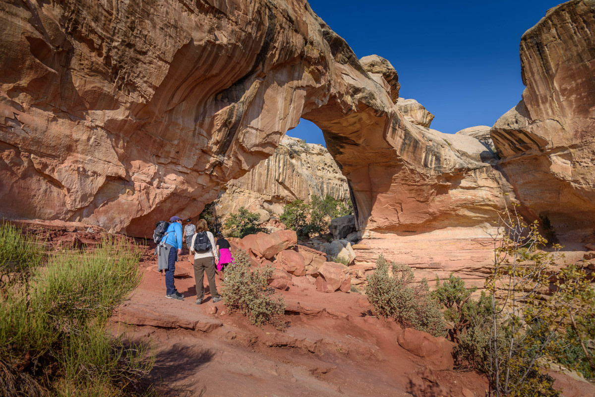
Hickman Natural Bridge – This is one of the parks most popular trails that leads hikers to a 133 ft natural stone arch and wonderful views of the canyon below. The trail is rated moderate with uneven steps and uphill climbing with 400 ft of elevation gain. This is also the trailhead for the Rim Overlook Trail that is rated strenuous and is nearly five miles round-trip. Due to the popularity of this trail the parking lot fills quickly. Go early if you can.
Navajo Dome Turnout – A short distance from the Hickman Bridge parking lot is a viewpoint of Navajo Dome located above the Hickman Bridge trail. This is an excellent photo opportunity for photographing one of the park’s iconic domes.
Grand Wash Pullout – This is the opposite end of Grand Wash from Scenic Drive. There is no parking lot but there is a pullout where you can park.
Behunin Cabin – Historic pioneer cabin belonging to Elijah Cutler Behunin, one of the original settlers in this region.
There are several pullouts along this stretch of road where you can get out of your car to take in the views.
All these points of interest can be visited in a day or less. If adding hikes you may need to eliminate some of the turnouts and depending on the length of your hike. We consider these the highlights of the park for sightseeing. To explore the park in greater depth and on off the pavement visit www.nps.gov/care or www.capitolreef.org
Keep Capitol Reef Country Forever Mighty
What is Forever Mighty? It’s practicing responsible travel while visiting Utah and Capitol Reef Country by following the principles of Tread Lightly and Leave No Trace.
Plan ahead and prepare, travel and camp on durable surfaces, dispose of waste properly, leave what you find, minimize campfire impacts, respect wildlife, be considerate of others, support local business and honor community, history and heritage. Help us keep Utah and Capitol Reef Country’s outdoor recreation areas beautiful, healthy, and accessible.
Planning your trip?
Get access to all the info in one book.Keep Exploring
More Adventures
Winter in Capitol Reef Country: Quiet Roads and Open Space
Winter slips into Capitol Reef Country almost unnoticed, softening red...
Read Article
Traveling Safe and Prepared in Capitol Reef Country’s Backcountry
The backcountry areas of Capitol Reef National Park in Utah...
Read Article
Discover Off-Season Fall Wonders in Capitol Reef Country, Utah
Travelers who want to experience solitude and natural beauty in...
Read Article