Explore Utah's Scenic Byway 12 - One of America's Most Scenic Roads
Utah’s Scenic Byway 12 is a gorgeous stretch of road that connects Wayne County and Garfield County, and is a popular drive for both tourists and locals. Designated as an All-American Road, you’ll find some of the most stunning scenery in the world as you wind through red-rock cliffs, deep slot canyons, alpine forests, historic towns, and national parks. Whether you pass through on a road trip, day drive or photo destination, this route offers unforgettable views and stops.
Taking a scenic drive on Byway 12 is an experience you won’t want to miss when you visit Capitol Reef Country. The whole route is about 124 miles long, fully-paved and open year round. However, keep in mind that snowfall and freezing temperatures may make some stretches of the highway less safe or temporarily impassible. Check the weather before you go and please travel with care!
How Long Does it Take to Drive Scenic Byway 12?
Without stops, the 124-mile drive takes around 3 hours. Some travelers drive Scenic Byway 12 all in one go, while others may turn it into a multi-day trip to check out the unique sites in the area. Below are some of the destinations you can enjoy on this unforgettable route.
Things to See Along Scenic Byway 12
Torrey, Utah
Torrey serves as a great base camp for exploring Capitol Reef Country, and sits at the north end of Scenic Byway 12. There are some fantastic restaurants and lodging options in Torrey, as well as convenient access to many of the parks and hiking trails in the area. Read more…
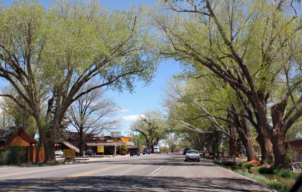
Location & Distance Information: Starting/ending point (east end): Mile 124, at junction with SR 24
Dixie National Forest
Your drive along Highway 12 will take you past a few areas of Dixie National Forest, a nearly 2-million acre expanse of outdoor lover’s paradise. The forest includes peaks and plateaus, lakes and valleys. Stop for a while or just take in the views as you go. Read more…
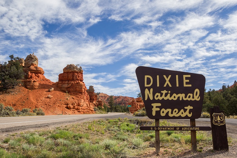
Location & Distance Information: Scattered throughout the route.
Capitol Reef National Park
The drive along Scenic Byway 12 also passes Capitol Reef National Park. While this incredible stretch of the Waterpocket Fold is worth a day’s visit or more all by itself, you can still appreciate the multi-colored rock and rolling hills in the distance as you pass. Read more…
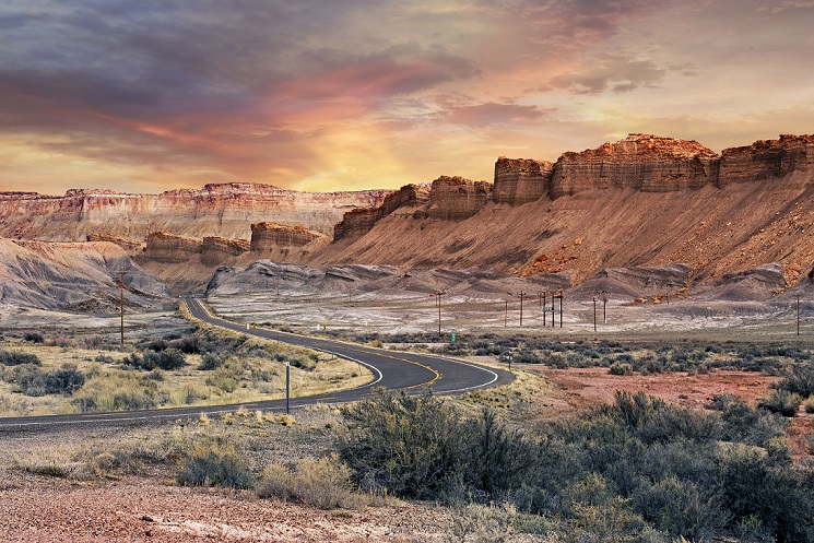
Location & Distance Information:
West→East: Capitol Reef is 11 miles east of Torrey via UT‑24, just before starting Scenic Byway 12.
East→West: Take a short 11-mile detour off UT‑24 before reaching Torrey and the beginning of Scenic Byway 12.
Larb Hollow Overlook
A lesser well-known spot worth stopping at for a moment along your scenic drive is a pullout called Larb Hollow Overlook. This is a point where the trees open up a bit and you can get a clear view across miles and miles of Utah’s natural beauty. This is a high-elevation point on the drive, so it provides a vantage point from above looking out across Capitol Reef to far off mountain peaks. Snap a picture or two, or just soak it in! Read more…
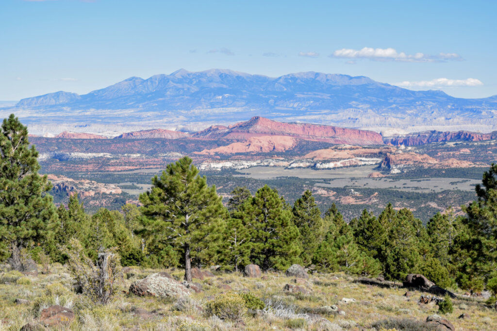
Location & Distance Information: West→East: Mile 109 at a high elevation scenic pullout
East→West: ~13 miles from Torrey
Boulder Mountain
Scenic Byway 12 crosses Boulder Mountain, the highest forested plateau in North America. Many anglers come to enjoy the great fishing in the high-mountain lakes scattered around Boulder Mountain and the surrounding DIxie National Forest. From this high point on the highway, you can see more than 100 miles on a clear day. Read more…
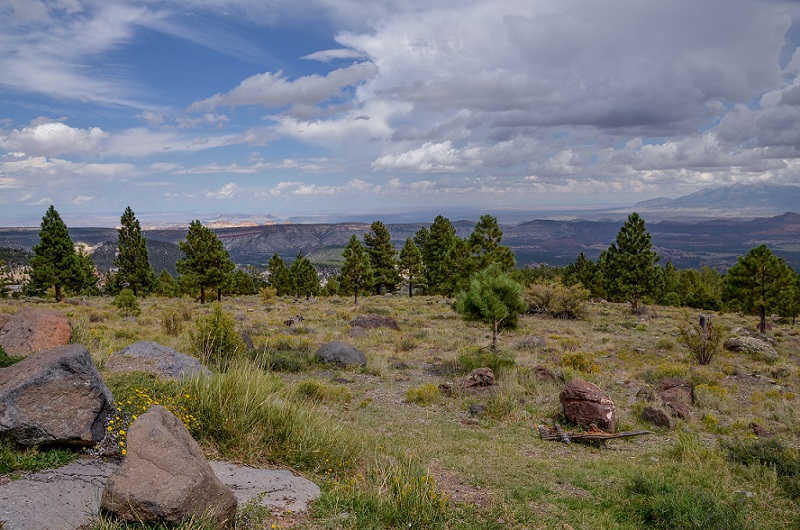
Location & Distance Information:
West→East: Miles 85–115, ascending Aquarius Plateau up to ~11,000 ft
East→West: spans from ~10 to 40 miles from Torrey
Anasazi State Park and Museum
The drive passes through the city of Boulder, where you can stop to see Anasazi State Park and Museum. This place was once home to around 200 or so Anasazi people between 1050 and 1200 AD. This ancient village is now a state park and museum, where guests can learn about the ancient culture and see some of the artifacts that have been unearthed there. Read more…
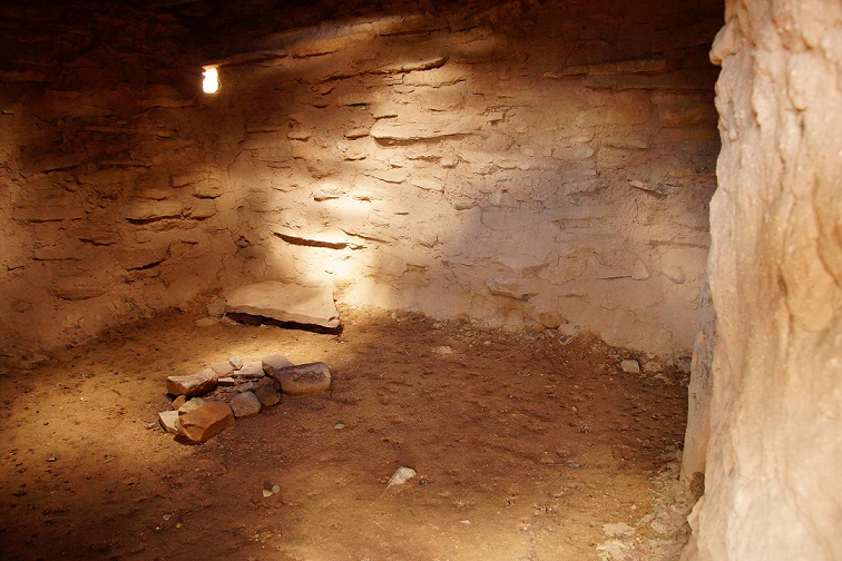
Location & Distance Information:
West→East: Mile 85–87 in Boulder town
East→West: ~38 miles from Torrey
The Hogback Area
At one point along Scenic Byway 12, between the communities of Boulder and Escalante, is a unique stretch of road called The Hogback. The road here runs along the top of a steep ridge, with the ground dropping drastically on each side of the road. Gaze out over the scenery to the left or the right while you slink atop the winding road above.
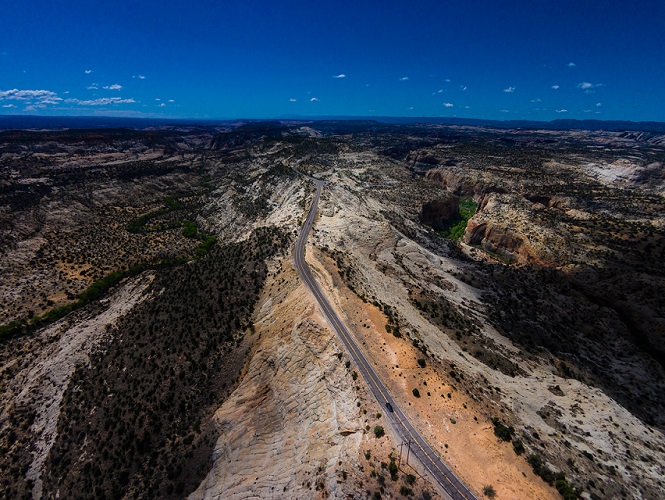
Location & Distance Information:
West→East: ~Mile 84–85, ridge section over Slickrock rim
East→West: ~40 miles from Torrey
Lower Calf Creek Falls
Right off the road, at a place called Calf Creek Campground is the beginning of a trailhead that leads to Lower Calf Creek Falls. Take some time for a hike to see this beautiful spot off the beaten path. It’s well worth it!
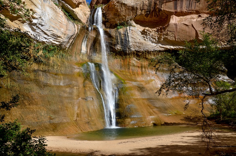
Location & Distance Information:
West→East: Mile 75 near Lower Calf Creek campground
East→West: ~49 miles from Torrey
Hole in the Rock Road
Just off Highway 12, Hole in the Rock Road offers 55 miles of off-roading adventures and sights to see. A historic road paved by pioneers. Highlights of this route include several slot canyons: Peek-a-Boo, Spooky, Zebra and many unique landscapes and natural arches like those found in Devil’s Garden. Road conditions vary – high clearance vehicles are recommended at times.
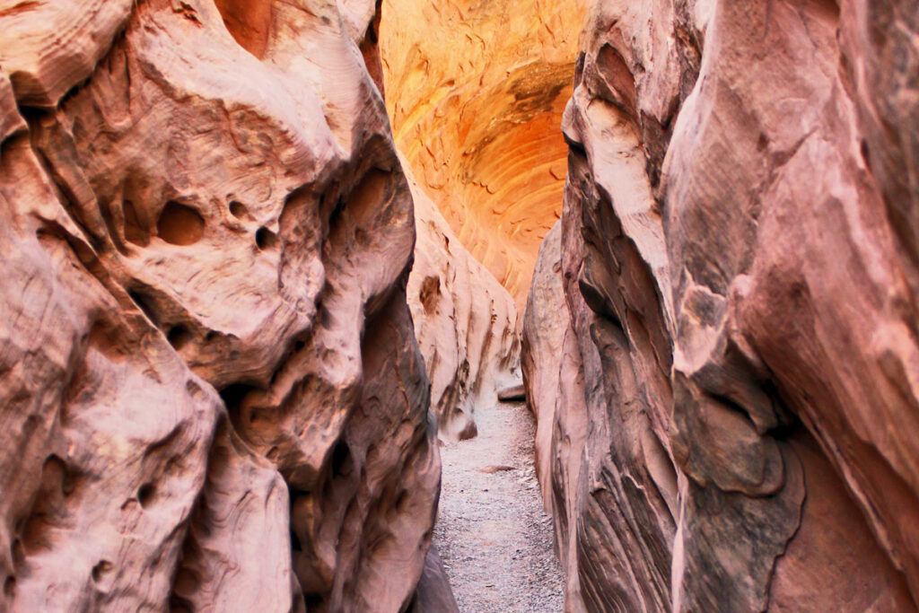
Location & Distance Information:
West→East: near Mile 71, just at Escalante
East→West: ~51 miles from Torrey
Escalante Natural Bridge
Another cool site you can get to from Scenic Byway 12 is Escalante Natural Bridge. This large stone arch was formed completely naturally but doesn’t happen very often in nature. The hike itself is as beautiful as the natural bridge.
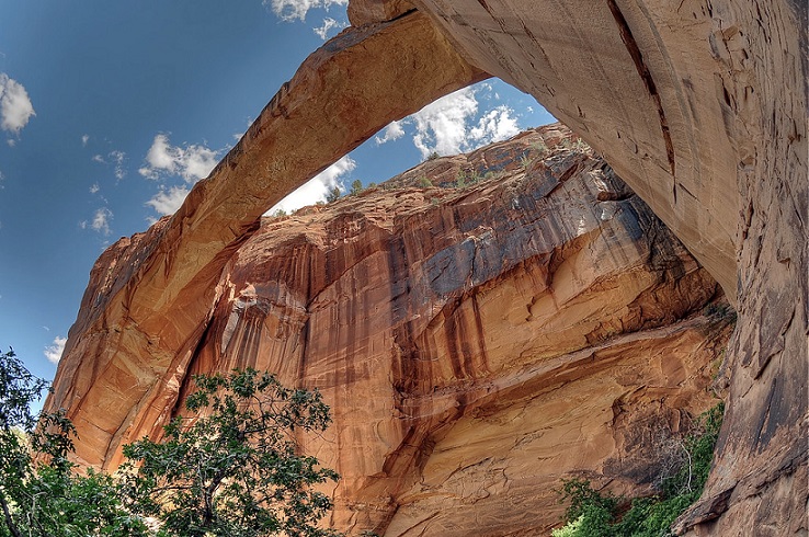
Location & Distance Information:
Trailhead at Mile 74 westbound
East→West: ~48 miles from Torrey
Grand Staircase-Escalante National Monument
The drive along Highway 12 also takes you past Grand Staircase-Escalante National Monument, one of the many nationally recognized attractions in Utah. Read more…
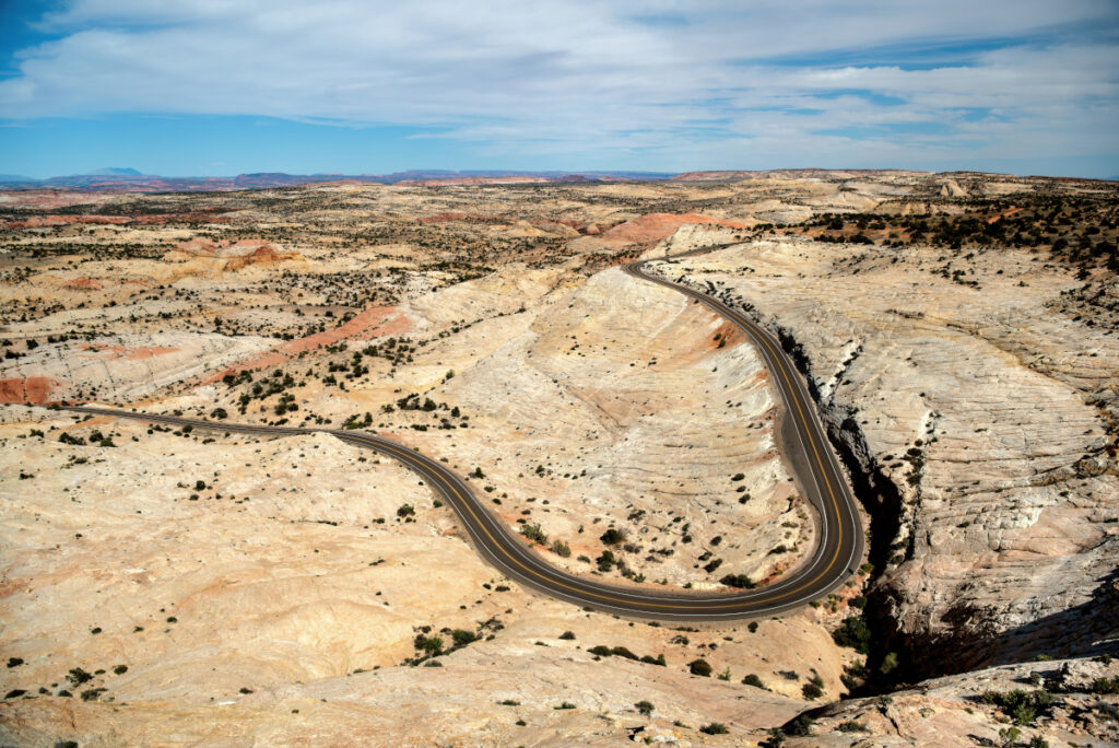
Location & Distance Information:
West→East: Begins near mile 17, stretches past Escalante
East→West: Begins west of Boulder, continues toward Bryce
Escalante Petrified Forest State Park
Just outside of the community of Escalante sits Escalante Petrified Forest State Park. This unique park has hiking trails and places to see a variety of petrified wood structures and other beautiful landscapes. Wide Hollow Reservoir is also at this location, along with some campsites.
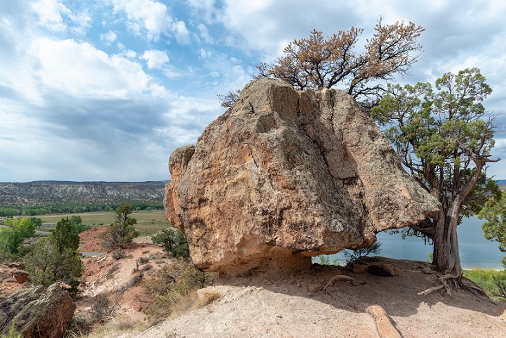
Location & Distance Information:
West→East: ~Mile 52–55, just west of Escalante
East→West: ~69 miles from Torrey
Drive Through Arches
It’s not every day that you get to drive under a rock arch, but your trip along this road will take you right through the cliffside. It’s just one of the many parts of Scenic Byway 12 that make this one of the most incredible highways in the world.
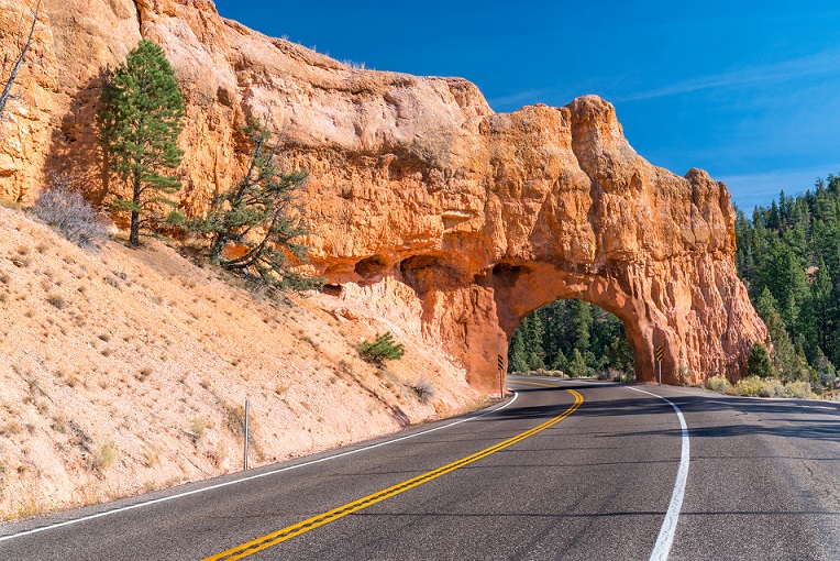
Location & Distance Information:
West→East: ~Mile 15–17, shortly after Bryce rim
East→West: ~107 miles from Torrey
Bryce Canyon National Park
If you head south on UT-63 off of Scenic Byway 12, you’ll get to Bryce Canyon National Park, where deep canyon corridors and towering “hoodoos” create a unique landscape that looks like something out of this world. Read more…
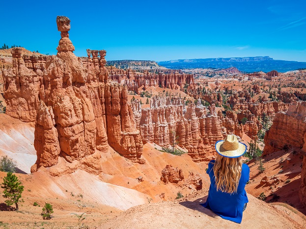
Location & Distance Information:
West direction: ~Mile 13 from US‑89 near Panguitch
East direction: ~111 miles from Torrey
Seasonal Tips for Traveling Scenic Byway 12
Scenic Byway 12 is beautiful year-round, but each season offers a unique experience. Here’s what you can expect throughout the year:
Spring (March–May):
Wildflowers bloom, waterfalls flow, and temperatures are generally mild but spring storms and late snow at high elevations (like Boulder Mountain) can still occur.
Summer (June–August):
Warm days and long daylight hours make summer a great time for hiking and sightseeing. Be prepared for hot temperatures in lower elevations and occasional afternoon thunderstorms. Some areas in this region can experience flash flooding as a result of heavy rain. Always check the weather before you hike in areas that may be prone to flash floods.
Fall (September–October):
Enjoy cooler temperatures and vibrant fall foliage, especially around Boulder Mountain. The fall leaves make this the most photogenic season and cooler weather is perfect for hikes.
Winter (November–February):
Winter offers fewer crowds, but snow and ice can impact driving conditions. Check weather and road conditions before traveling.
Scenic Byway 12 FAQ
How far is Bryce Canyon from Torrey, Utah?
Bryce Canyon is about 110 miles from Torrey, Utah and around 2 hours and 20 minutes of drive time along Scenic Byway 12. You can get between Torrey and Bryce Canyon a little faster if you go through Koosharem and Widtsoe, but it’s nowhere near as beautiful of a drive!
How far is Capitol Reef from Bryce Canyon?
Taking Highway 12, Capitol Reef National Park is 122 miles, 2.5 hours from Bryce Canyon. You can save about 15 minutes of drive time and sacrifice a chance to experience the “#2 most beautiful highway in the world” by going a different route, but we think the scenic route is 15 more minutes well-spent!
Where does Scenic Byway 12 start and end?
Scenic Byway 12 begins in Torrey, UT, just outside Capitol Reef National Park, and winds southeast through Garfield and Wayne Counties, ending near Boulder, where it connects near Bryce Canyon via UT‑63.
Are RVs and trailers allowed?
Yes, RVs and trailers are allowed on Byway 12. However, use caution on sections like The Hogback, where lanes are narrow and shoulders are soft.
Can I camp along Scenic Byway 12?
There are several developed campgrounds in Dixie National Forest, as well as options for dispersed camping near Escalante and Capitol Reef. Familiarize yourself with local fire regulations and areas camping isn’t allowed.
Are there hikes along Scenic Byway 12?
Yes! The route offers hikes like Lower Calf Creek Falls, Escalante Natural Bridge, and a number of scenic slot canyons off Hole-in-the-Rock Road. Difficulty ranges from easy day walks to moderate canyon treks.
Are there gas stations and cell service on Scenic Byway 12?
Yes, there are gas stations in the towns of Torrey, Boulder, and Escalante. Services between towns can be sparse so it’s a good idea to fill up before you head out.
Is cell service available along Scenic Byway 12?
Cell service is limited or nonexistent in many stretches of the byway, including Boulder Mountain and some canyon regions. It’s a good idea to be prepared with downloaded maps offline and a well-equipped vehicle in case of an emergency in an area without cell service.
Plan Your Visit
Capitol Reef Country is filled with comfortable accommodations for every interest and budget.
Every mile of Scenic Byway 12 offers a new photo opportunity.
