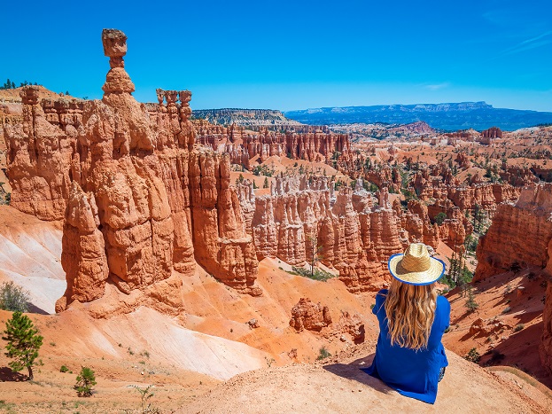
EXPLORE BRYCE CANYON NATIONAL PARK
Bryce Canyon is a short drive from Capitol Reef Country making it a great day trip while visiting this area. Encompassing approximately 36,000 acres Bryce Canyon National Park is actually a series of fourteen amphitheaters that run in a north-south direction along the southeastern edge of the Paunsagunt Plateau for a distance of approximately 20 miles. The largest of the rock amphitheaters, Bryce Amphitheater, is 12 miles long, 3 miles wide, and 800 feet deep. On top of the plateau, Bryce Canyon begins in elevation at approximately 8,000 feet and rises to just over 9,000 feet. East of the plateau is the Paria River Valley and in the distance, various formations can be seen such as Powell Point, Navajo Mountain, and the Kaiparowitz Plateau.
GEOLOGY
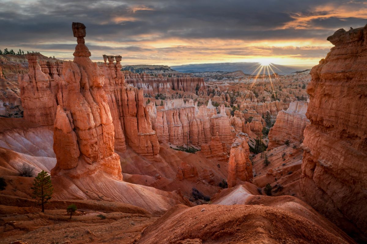
Bryce Canyon amphitheaters have formed, over millennia, as layers of sandstone and shale and iron-rich sandstone and conglomerates were deposited in layers. The last layers called the Claron Formation, are part of the famous Pink Cliffs which form the upper portions of the Grand Staircase.
As streams of water flow from the plateau, they have created thin ridges in the rock contours of the cliffs, known as fins. As these fins erode, they create impressive individual tower formations, at Bryce Canyon, known as hoodoos. These pinnacles have been colored by iron oxide, limonite, and magnesium oxide. With freezing night temperatures in winter, water which has seeped into the rock’s crevices turns to ice. The frozen water then expands and fractures the rock formations creating a cycle of continuing erosion.
HISTORY
ANCIENT HISTORY
Over thousands of years, various cultures have inhabited the region surrounding Bryce Canyon National Park. As early as 10,000 years ago, Paleo-Indians hunted large mammals in the region. Then approximately 2,000 years ago, the area became inhabited by the Ancestral Puebloans or the Anasazi who used the area to harvest pine nuts and also to hunt wildlife.
The Bryce Canyon region was next inhabited by the Fremont culture, which lived in the area up until about 1200 AD. Finally, the Paiute people entered the region and stayed until the twentieth century. Hoodoos, a word which is believed to mean “red painted faces” in the Paiute language, were said to be people turned to stone after they had become victims of a displeased coyote.
RECENT HISTORY
A Spanish explorer passed through this region in 1776 and then Americans began to explore the area in the mid 1800’s. Mormon settlers first surveyed the area in an attempt to discern its usefulness for grazing and other types of habitation. The area was later surveyed by Major John Wesley Powell in 1872. In 1874, the Church of Jesus Christ of Latter-day Saints sent Ebenezer Bryce, the national park’s namesake, to settle the area. Bryce and other settlers soon inhabited the area right below what is known today as Bryce Amphitheater. On one occasion, Ebenezer Bryce lost some of his cattle and he entered one of the nearby Bryce Canyon amphitheaters in search of his animals. His comment upon discovery of this amazing scene, “It’s one hell of a place to lose a cow.”
The area around Bryce National Park first began to gain some notoriety around 1916 when articles of its magnificence were published in several magazines. As interest grew in the Bryce Canyon conservationist Stephen Mather moved to have the area designated as a state park. The Utah governor and state legislature, however, pushed to have the region designated as a national monument, which occurred officially in 1923. Then in February of 1928, the area was designated as Bryce Canyon National Park.
PLANNING YOUR TRIP TO BRYCE CANYON
EXPERIENCE THE REGION FROM ONE LOCATION
Visitors to this region will appreciate their ability to stay in one place and experience great adventure and scenery in all directions. To the south of Capitol Reef National Park is Bryce Canyon, one of the most unique national parks in the United States. Bryce Canyon is accessible from Capitol Reef via All-American Scenic Byway 12. This road from Capitol Reef to Bryce Canyon is spectacular with many scenic views and side attractions to enjoy. Learn more about the Capitol Reef area.
HOW TO GET TO BRYCE CANYON
Travel south from the Capitol Reef region on Byway 12. Along the way don’t miss such attractions as; the Burr Trail, Anasazi Indian Village State Park, Calf Creek Falls, Hole in the Rock Road, Devil’s Garden, and Kodachrome Basin State Park.
CAMPING IN BRYCE CANYON
Bryce Canyon National Park is full of great opportunities for camping. With a variety of elevations and environments throughout the park, Bryce Canyon is a great place to experience different types of vegetation. Inside the park, there are a number of great camping locations, as well as some of the best free camping in Utah.
Learn more about Bryce Canyon.
435-834-5322
Bryce Canyon National Park offers stunning viewpoints and hiking trails that showcase its unique hoodoo-filled amphitheaters and vibrant geological formations. Below is a description of the main viewpoints and the top five hiking trails, tailored for a day trip context from Torrey, Utah, based on accessibility, popularity, and scenic impact.
Main Viewpoints at Bryce Canyon
Bryce Canyon’s viewpoints are primarily along the main park road and the 18-mile Scenic Drive, offering panoramic vistas of the amphitheater and beyond. Most are accessible by car or short walks, ideal for a day trip. Here are the key ones:
- Sunrise Point (8,000 ft elevation):
- Offers a direct view of the main Bryce Amphitheater, with sprawling hoodoos glowing at dawn. It’s a great starting point for hikes like Queen’s Garden.
- Easy access, parking available, and part of the Rim Trail.
- Sunset Point (8,000 ft):
- Just 0.5 miles from Sunrise Point, it provides a slightly different angle of the amphitheater, famous for the iconic Thor’s Hammer hoodoo. Ideal for Navajo Loop Trail access.
- Busy but spacious, with restrooms nearby.
- Inspiration Point (8,100 ft):
- A short walk uphill reveals multi-tiered views of the amphitheater’s hoodoos and the Silent City formation. Perfect for photography, especially at midday.
- Less crowded than Sunrise/Sunset Points.
- Bryce Point (8,300 ft):
- Offers one of the most expansive views, including the full amphitheater and distant Grand Staircase-Escalante. It’s a prime spot for sunrise and access to the Peekaboo Loop.
- Slightly farther but worth the drive.
- Rainbow Point (9,100 ft):
- At the end of the Scenic Drive, it’s the highest viewpoint, offering vistas of southern Utah’s plateaus and the Yovimpa Point trail. Less amphitheater-focused but vast and serene.
- Ideal for a quick stop on the Scenic Drive.
- Natural Bridge (8,627 ft):
- A pullout on the Scenic Drive showcasing a natural arch (not a bridge) framed by ponderosa pines. Great for a quick photo without hiking.
- Midway along the drive, minimal walking required.
- Yovimpa Point (9,100 ft):
- Adjacent to Rainbow Point, it provides views southward toward Arizona’s plateaus. Less crowded, with a short trail option for deeper exploration.
- Good for a final stop before heading back.
Note: Viewpoints like Paria View and Farview Point are also scenic but less essential for a day trip due to time constraints. Prioritize Sunrise, Sunset, Inspiration, Bryce, and Rainbow for a balanced visit.
Top 5 Hiking Trails at Bryce Canyon
These trails are selected for their scenic value, moderate difficulty, and suitability for a day trip (considering ~6-8 hours in the park). Distances and times are approximate, and trails are listed from most accessible to more demanding.
- Queen’s Garden/Navajo Loop Combination
- Distance: 2.9 miles (loop)
- Time: 2-3 hours
- Difficulty: Moderate
- Description: The quintessential Bryce hike, combining the easiest descent into the amphitheater (Queen’s Garden from Sunrise Point) with the dramatic switchbacks of Navajo Loop (from Sunset Point). Highlights include the Queen Victoria hoodoo, Two Bridges, and Thor’s Hammer. The trail winds through colorful hoodoos and slot canyons, offering an immersive experience.
- Why Top: Best balance of accessibility, scenery, and moderate effort. Ideal for a day trip’s morning activity.
- Tips: Start at Sunrise Point to descend Queen’s Garden (easier on knees); clockwise loop is less steep. Check for trail closures (Navajo’s Wall Street section may close in spring due to ice).
- Rim Trail (Sunrise to Sunset Point)
- Distance: 1-2 miles (out and back or one-way)
- Time: 1-1.5 hours
- Difficulty: Easy
- Description: A paved and mostly flat trail along the amphitheater’s edge, connecting Sunrise and Sunset Points (extendable to Inspiration or Bryce Points). It offers constant views of the hoodoos without steep descents, making it perfect for all fitness levels or limited time.
- Why Top: Accessible, quick, and delivers panoramic views. Great for families or if you want a low-effort option after driving from Torrey.
- Tips: Park at one point and shuttle back (seasonal shuttle runs May-Oct) or walk round-trip. Early morning minimizes crowds.
- Mossy Cave Trail
- Distance: 0.8 miles (out and back)
- Time: 30-45 minutes
- Difficulty: Easy
- Description: Located off UT-12 near the park’s entrance (not in the main amphitheater), this short trail leads to a mossy alcove with a small waterfall and hoodoos. It’s less crowded, offering a quieter experience with views of Tropic Valley.
- Why Top: Quick and unique, perfect for a late afternoon stop on your way back to Torrey. Minimal elevation gain suits a packed day.
- Tips: Park at the small lot on UT-12. Avoid after heavy rain due to mud. No park entry fee required for this trail.
- Peekaboo Loop
- Distance: 5.5 miles (loop, from Bryce Point)
- Time: 3-4 hours
- Difficulty: Moderate to strenuous
- Description: Starting at Bryce Point, this trail descends into the amphitheater, weaving through hoodoos, tunnels, and the Wall of Windows. It’s a deeper exploration of the park’s interior, with varied terrain and fewer crowds than Queen’s Garden. Can be combined with Navajo Loop for a longer hike.
- Why Top: Offers a more adventurous experience for fit hikers with time after the Scenic Drive. Stunning, less-trafficked views.
- Tips: Steep elevation changes (~1,500 ft); start early if combining with other activities. Bring water and trekking poles for stability.
- Fairyland Loop
- Distance: 8 miles (loop, from Fairyland Point)
- Time: 4-5 hours
- Difficulty: Strenuous
- Description: Starting at Fairyland Point (north of the main entrance), this trail descends into Fairyland Canyon, passing unique hoodoos like Tower Bridge and China Wall. It includes Rim Trail sections for expansive views. Less crowded but demanding due to length and ~1,700 ft elevation gain.
- Why Top: Ideal for avid hikers seeking solitude and diverse scenery, though it may push day trip time limits.
- Tips: Start very early (e.g., 7:00 AM) to fit into a day trip. Not recommended if prioritizing viewpoints or shorter hikes. Water and snacks essential.
Day Trip Considerations
- Time Management: For a day trip from Torrey (~4 hours driving), prioritize Queen’s Garden/Navajo Loop (morning) and Mossy Cave (afternoon) to balance hiking with Scenic Drive viewpoints (Sunrise, Sunset, Inspiration, Bryce, Rainbow). Rim Trail is a good backup if time is tight.
- Conditions: Spring (May) can bring muddy or icy trails, especially in shaded areas like Navajo Loop’s Wall Street. Check trail status at the Visitor Center or nps.gov/brca. High elevation (8,000-9,000 ft) means hydration and sun protection are critical.
- Access: All viewpoints and trails (except Mossy Cave) are within the park’s fee area ($35/vehicle or National Parks Pass). Mossy Cave is free but has limited parking.
- Gear: Wear sturdy shoes (trails can be rocky or slippery), bring water (1L/person minimum), and layer clothing for cool mornings and warm afternoons.
This covers the key viewpoints and top trails for a memorable Bryce Canyon day trip.
Hours of Access at Bryce Canyon National Park
- Park Access: Bryce Canyon National Park is open 24 hours a day, 7 days a week, year-round, including holidays. You can enter and exit at any time, though some facilities and services have specific hours.
- Entrance Stations: The main entrance station (on UT-63, near the park’s north end) is staffed during daylight hours, typically from 8:00 AM to 6:00 PM in spring (May), with extended hours (e.g., 8:00 AM to 8:00 PM) in peak summer months. Outside these hours, the entrance is unstaffed, but you’ll need a valid park pass or pay the $35/vehicle fee upon exit or at a self-service kiosk if re-entering later.
- Roads and Scenic Drive: The main park road and the 18-mile Scenic Drive to Rainbow Point are open 24/7, weather permitting. In spring, temporary closures may occur due to snow or ice, but this is rare by mid-May. Check nps.gov/brca or at the Visitor Center for real-time road status.
- Parking Areas: Viewpoint parking lots (e.g., Sunrise, Sunset, Bryce, Rainbow Points) are accessible 24/7, though they can fill up during peak daytime hours (10:00 AM–2:00 PM). Overnight parking is allowed only for backcountry campers with permits.
Visitor Center Hours
- Location: The Bryce Canyon Visitor Center is just past the main entrance, near the park’s north end.
- Hours (as of May 2025):
- Open daily from 8:00 AM to 6:00 PM in spring (April–May).
- Hours extend to 8:00 AM to 8:00 PM in summer (June–August) and reduce to 8:00 AM to 4:30 PM in winter (November–March).
- Closed on Thanksgiving Day, Christmas Day, and New Year’s Day.
- Services: Offers maps, trail advice, ranger programs, exhibits, restrooms, water refill stations, and a bookstore. Rangers can provide current trail and weather conditions, critical for a day trip in May when trails may be muddy or icy.
- Contact: Call (435) 834-5322 for updates or check nps.gov/brca before your trip.
Day Trip Context (from Torrey, Utah)
- Arrival Timing: For a day trip from Torrey (~2-hour drive), aim to arrive by 8:00 AM when the Visitor Center opens. This aligns with entrance station staffing and allows you to grab maps or check conditions before hitting viewpoints (e.g., Sunrise Point) or trails (e.g., Queen’s Garden/Navajo Loop).
- After-Hours Access: If you stay past 6:00 PM (Visitor Center closing), viewpoints and trails remain accessible, but no ranger services or facilities will be available. Ensure you have water, offline maps, and a full gas tank, as services are limited after hours.
Additional Notes
- Shuttle Service: The park’s optional shuttle (running May–October) operates from ~8:00 AM to 6:00 PM (sometimes later in summer), stopping at key viewpoints and trailheads. It’s useful for a day trip to avoid parking hassles at busy spots like Sunset Point.
- Mossy Cave Trail: This trail, outside the main park on UT-12, has no gate or fee and is accessible 24/7, though its parking lot is small and unmonitored.
- Weather Considerations: In May, daytime temps range from 40–70°F, but early morning or evening visits (outside Visitor Center hours) can be chilly at 8,000–9,000 ft elevation. Bring layers if arriving before 8:00 AM or staying past 6:00 PM.
- Real-Time Updates: Hours and access can change due to weather or staffing.
